UN
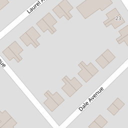
4 Dale Avenue
£ 122,500
Description
We don't have a Description for this property.
- Bedrooms
- 3
- Bathrooms
- 0
- Sqft
- 1,035.00


Leaflet © OpenStreetMap contributors
The heatmap indicates the level of crime in the area. The color of the heatmap indicates the crime severity and recency.
Metrics Year-on-Year
- Average area value
- 614,428.00 £Increased by 5.11 %
- Est sale value
- 401,580.00 £Decreased by 2.27 %
- Average area rental value
- 1,569.00 £/moIncreased by 44.21 %
- Est letting value
- 0.00 £/mo
- Est rental Yield
- 3.06 %Increased by 37.22 %
- Crime Rate
- 10.00 %Unchanged by 0.00 %
from 584,545.00 £
from 410,895.00 £
from 1,088.00 £/mo
from 0.00 £/mo
from 2.23 %
from 10.00 %
Nearby Schools
| Name | Type | Ofsted | Distance |
|---|---|---|---|
| Heswall St Peter'S Cofe Primary School | Voluntary Aided School | Good | 0.65 KM |
| Heswall Primary School | Community School | Good | 1.05 KM |
| Stanley School | Community Special School | Good | 1.27 KM |
| Pensby Primary School | Community School | Good | 1.27 KM |
| Ladymount Catholic Primary School | Voluntary Aided School | Good | 1.30 KM |
Images
Nearby Streets
| Name | Average Price | Average Sqft | Distance |
|---|---|---|---|
| Grove Avenue | £ 0 | 0 | 0.00 KM |
| Heath Drive | £ 450,000 | 0 | 0.00 KM |
| Circular Drive | £ 600,000 | 0 | 0.00 KM |
| Dawstone Court | £ 0 | 0 | 0.00 KM |
| Constantine Avenue | £ 0 | 0 | 0.00 KM |
Nearby Transport
| Name | NLC | TLC | Distance |
|---|---|---|---|
| Heswall | 2138 | HSW | 2.93 KM |
| Neston | 2139 | NES | 5.95 KM |
| Upton (Merseyside) | 2141 | UPT | 6.46 KM |
| Leasowe | 2237 | LSW | 8.60 KM |
| Moreton (Merseyside) | 2151 | MRT | 8.64 KM |
Nearby Listings
| Address | Price | Type | Score | Distance |
|---|---|---|---|---|
| Dale Avenue, Heswall, Wirral | £ 125,000 | BUY | Unknown | 0.05 KM |
| Dale Avenue, Heswall, Wirral | £ 95,000 | BUY | Unknown | 0.05 KM |
| Dale Avenue, Heswall, Wirral, CH60 | £ 115,000 | BUY | 6 / 10 | 0.05 KM |
| Tower Road South, Heswall, Wirral | £ 320,000 | BUY | 7 / 10 | 0.14 KM |
| Tower Road South, Heswall, Wirral | £ 300,000 | BUY | Unknown | 0.15 KM |
Nearby Properties
| Address | Price | Distance |
|---|---|---|
| 4 Dale Avenue | £ 122,500 | 0.00 KM |
| 14 Dale Avenue | £ 131,000 | 0.00 KM |
| 6 Dale Avenue | £ 164,000 | 0.02 KM |
| 16 Dale Avenue | £ 207,000 | 0.02 KM |
| 15 Dale Avenue | £ 174,500 | 0.02 KM |